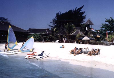
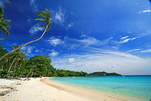
Lombok is an island in West Nusa Tenggara (Nusa Tenggara Barat or NTB) province, Indonesia. It forms part of the chain of the Lesser Sunda Islands, with the Lombok Strait separating it from Bali to the west and the Alas Strait between it and Sumbawa to the east. It is roughly circular, with a "tail" (Sekotong Peninsula) to the southwest, about 70 km across and a total area of about 4,725 km² (1,825 sq mi). The provincial capital and largest city on the island is Mataram. It is somewhat similar in size and density with neighboring Bali and shares some cultural heritage, and is now like its neighbor become a hot tourist destination, but is administratively part of NTB along with sparsely populated Sumbawa. It is surrounded by a number of smaller islands locally called Gili.
The island is home to some 3.16 million Indonesians [1][2][3] as recorded in the decennial 2010 census, and in 4 regencies along with the provincial capital Mataram.

The Lombok Strait lies to the immediate west of the island and this waterway marks the passage of the biogeographical division between the fauna of the Indomalayan ecozone and the distinctly different fauna of Australasia that is known as the Wallace Line, for Alfred Russel Wallace [1], who first remarked upon the distinction between these two major biogeographical regions and how abrupt the boundary was between the two biomes.[4]
To the east of Lombok lies the Alas Strait, a narrow body of water separating the island of Lombok from the nearby island of Sumbawa to the east.
The island's topography is dominated by the centrally-located stratovolcano Mount Rinjani, which rises to 3,726 m (12,224 ft), making the second highest volcano in Indonesia and the nations third highest mountain. The most recent eruption of Rinjani was in May, 2010 at Gunung Barujari. Ash was reported as rising up to two km into the atmosphere from the Barujari cone in Rinjani's caldera lake of Segara Anak. Lava flowed into the caldera lake, pushing its temperature up and crops on the slopes of Rinjani were damaged by ash fall. The volcano, and its crater lake, 'Segara Anak' (child of the sea), are protected by the Gunung Rinjani National Park established in 1997.
The highlands of Lombok are forest clad and mostly undeveloped. The lowlands are highly cultivated. Rice, soybeans, coffee, tobacco, cotton, cinnamon, cacao, cloves, cassava, corn, coconuts, copra, bananas and vanilla are the major crops grown in the fertile soils of the island. The southern part of the island is fertile but dryer especially toward the southern coastline.
The water supply in Lombok is stressed and this places strain upon both the water supply of the provincial capital, Mataram, and the island in general. The southern and central areas are reported to be the most critically effected. West Nusa Tenggara province in general is threatened with a with water crisis caused by increasing forest and water table damage and degradation. 160 thousand hectares of a total of 1960 thousand hectares are thought to have been effected. The Head of Built Environment and Security Forest Service Forest West Nusa Tenggara Andi Pramari stated in Mataram on Wednesday, May 6, 2009 that, "If this situation is not addressed it can be expected that within five years it may be difficult for people to obtain water in this part of NTB (West Nusa Tenggara). Not only that, the productivity of agriculture in value added will fall, and the residents are experiencing water deficiency in their wells". High cases of timber theft in the region of NTB are contributing to this problem.[5] In September 2010 Central Lombok some villagers were reported to be walking for several hours to fetch a single pail of water. Nieleando, a small coastal village about 50 kilometers from the provincial capital, Mataram, has seen dry wells for years. It has been reported that occasionally the problem escalates sufficiently for disputes and fighting between villagers to occur. The problems have been reported to be most pronounced in the subdistricts of Jonggat, Janapria, Praya Timur, Praya Barat, Praya Barat Daya and Pujut. In 2010 all six sub-districts were declared drought areas by provincial authorities.[6] Sumbawa, the other main island of the province, also has experienced severe drought in 2010, making it a province-wide issue.[7]